THE MRIDANSH
Project Name
Core Engine
Category
Status
THE MRIDANSH
Overview
THE MRIDANSH is a physics-guided, AI-driven Unified Soil State Estimation System designed to generate the current best scientific estimate of soil conditions by integrating multi-modal Earth observation data, environmental information, historical observations, and state estimation techniques.
The system treats soil as a dynamic physical system rather than a static geographic property. It combines:
- Optical satellite imagery
- Synthetic Aperture Radar (SAR)
- Digital Elevation Models
- Weather observations
- Historical satellite time-series
- Optional prior soil information
These inputs are processed through a unified computational framework to estimate the hydro-physical, biogeochemical, terrain, and reliability state of soil.
Core Objective
The primary objective of THE MRIDANSH is not to directly solve a specific agricultural or civil-engineering problem. Instead, the system produces a reusable:
Unified Soil State Vector
This common scientific representation becomes the foundation for multiple downstream applications.
Unified Soil State
The estimated soil state includes several categories:
Hydro-Physical State
- Root-Zone Moisture
- Bulk Density
- Hydraulic Conductivity
- Soil Temperature
Biogeochemical State
- Organic Carbon
- Estimated Nitrogen
- Estimated Phosphorus
- Estimated Potassium
Terrain State
- Elevation
- Slope
- Aspect
- Soil Layer Stratification
Reliability State
- Confidence Score
- Uncertainty Matrix
- Observation Freshness
Multi-Domain Architecture
The same Unified Soil State can be translated into domain-specific information.
                THE MRIDANSH
                      │
             Unified Soil State
                      │
          ┌───────────┴───────────┐
          ▼                       ▼
    AGRICULTURE              CIVIL ENGINEERING
          │                       │
   Agronomic Translator      Geotechnical Translator
Agriculture
The system can provide:
- Root-zone moisture analytics
- Soil health information
- Estimated organic carbon
- Estimated NPK status
- Scenario simulation
- Precision-management analytics
Civil Engineering
The system can provide:
- Ground stability information
- Soil-state visualization
- Scenario simulation
- Subsurface 3D profiles
- Basic drainage intelligence
Note: Advanced geotechnical analysis is intentionally delegated to downstream systems such as MARGAVEDHA.
Core Scientific Engine
The central computational engine is AETHER-MRID1607X. The engine integrates:
- Multi-modal data fusion
- Physics-guided state evolution
- Ensemble Kalman Filter-based data assimilation
- AI-based spatial and temporal modeling
- Unified soil-state estimation
- Domain translation
Scientific Philosophy
THE MRIDANSH is built around the idea that Earth observation data should not simply produce isolated maps or predictions. Instead, observations should continuously update an evolving representation of the physical state of the soil.
Observation → State Estimation → Prediction → Observation Update → State Correction → Updated Soil State
Long-Term Vision
THE MRIDANSH is envisioned as a foundational Earth Intelligence platform capable of supporting:
- Precision agriculture
- Geotechnical intelligence
- Environmental monitoring
- Disaster resilience
- Soil dynamics analysis
- Future digital-twin applications
The central idea is to create one scientifically consistent soil representation that can serve many downstream systems.
One-Line Description
THE MRIDANSH is a physics-guided AI system that estimates the current best scientific state of soil from multi-modal Earth observation data, providing a unified foundation for agriculture and civil engineering applications.
THE MRIDANSH — Problem Definition
The Core Problem
Soil is not a static surface property. It is a dynamic physical system influenced by:
- Rainfall
- Temperature
- Solar radiation
- Moisture transport
- Terrain
- Vegetation
- Human activity
- Time
- Subsurface conditions
However, many conventional Earth-observation workflows treat individual observations as isolated products. This creates a fundamental problem:
How can heterogeneous observations be transformed into a continuously updated estimate of the actual physical state of soil?
Fragmented Earth Observation
Modern Earth observation provides enormous amounts of information. Different sensors observe different properties:
- Sentinel-2: Optical / Spectral Information
- Sentinel-1: Radar / Surface and Structural Information
- Copernicus DEM: Terrain Information
- Weather Data: Environmental Forcing
- Historical Archive: Temporal Context
Individually, these datasets provide valuable information. The challenge is combining them into one scientifically consistent representation.
Temporal Problem
A satellite observation represents the Earth's state at a particular observation time. But soil conditions continuously evolve:
Rainfall → Infiltration → Moisture Redistribution → Evaporation / Drainage → New Soil State
Therefore, a single satellite image cannot fully represent the evolving state of soil. THE MRIDANSH addresses this through temporal modeling and sequential state estimation.
Multi-Modal Data Problem
Different sensors have:
- Different spatial resolutions
- Different temporal resolutions
- Different physical measurement mechanisms
- Different noise characteristics
- Different data formats
- Different observation conditions
These datasets cannot simply be stacked together without appropriate processing. The system therefore requires:
- Spatial alignment
- Temporal alignment
- Data-quality assessment
- Feature engineering
- Sensor-specific preprocessing
- Dynamic data fusion
Cloud and Observation Availability
Optical satellite observations can be affected by cloud conditions. THE MRIDANSH therefore explores an adaptive observation strategy:
- Cloud < 20%: Sentinel-2 Optical
- Cloud ≥ 20%: Sentinel-1 SAR
This allows radar observations to provide complementary information when optical observations become less reliable.
State Estimation Problem
The system does not simply ask: "What does this satellite image show?"
It asks: "Given everything observed so far, what is the current best scientific estimate of the soil state?"
Conceptually: Previous Soil State + Physical Evolution + New Observations → State Estimation → Current Best Soil State
Uncertainty Problem
Earth observation predictions are never perfectly certain. Sources of uncertainty may include:
- Sensor noise
- Missing observations
- Atmospheric conditions
- Model limitations
- Temporal gaps
- Spatial heterogeneity
- Imperfect prior information
Therefore, the system must not treat every estimate as equally reliable. THE MRIDANSH incorporates reliability information such as:
- Confidence Score
- Uncertainty Matrix
- Observation Freshness
Cross-Domain Problem
Agriculture and civil engineering require different outputs:
- Agriculture: Root-Zone Moisture, Organic Carbon, NPK Estimation, Precision Management
- Civil Engineering: Ground Stability, Drainage, Soil Profiles, Engineering Indicators
Building separate independent systems for every application would duplicate the underlying scientific work. THE MRIDANSH instead addresses the problem through a shared scientific core:
                Unified Soil State
                       │
          ┌────────────┴────────────┐
          ▼                         ▼
    Agriculture               Civil Engineering
Core Research Problem
How can multi-modal Earth observation, environmental forcing, physical constraints, and sequential data assimilation be combined to estimate a continuously evolving and uncertainty-aware state of soil?
Engineering Goal
The objective is to create a reusable scientific core rather than an application-specific prediction model. This core can then support multiple downstream Earth-intelligence systems.
THE MRIDANSH — Proposed Solution
Solution Overview
THE MRIDANSH addresses the soil-state estimation problem through a physics-guided, AI-driven, multi-modal data assimilation architecture.
The system transforms heterogeneous Earth observation and environmental observations into a continuously updated:
Unified Soil State Vector
Core Concept
The proposed solution follows this sequence:
Multi-Modal Observations → Data Quality & Preprocessing → Spatio-Temporal Data Fusion → AETHER-MRID1607X → State Estimation → Physics-Guided State Evolution → Unified Soil State Vector → Domain Translators → Agriculture / Civil Applications
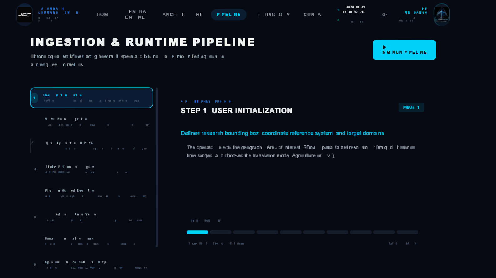
Step 1 — User Initialization
The user defines the computational request. Inputs include Area of Interest (AOI) / Bounding Box, spatial resolution, time range, and output mode (Agriculture or Civil).
User → AOI → Resolution → Time Range → Output Mode
Step 2 — Multi-Modal Data Ingestion
THE MRIDANSH collects multiple Earth observation and environmental datasets:
- Satellite Data: Sentinel-1 SAR, Sentinel-2 Optical
- Terrain: Copernicus DEM
- Environmental Data: Rainfall, Temperature, Humidity, Solar Radiation
- Historical Information: Multi-year satellite archive, Optional prior soil maps
The objective is to create a multi-dimensional observational description of the target region.
Step 3 — Data Quality and Preprocessing
The acquired datasets pass through preprocessing and quality-control operations.
Optical/SAR Observation Strategy:
- Cloud < 20%: Sentinel-2 Optical
- Cloud ≥ 20%: Sentinel-1 SAR
Additional processing includes DEM terrain normalization, spatial and temporal alignment, noise reduction, radiometric correction, feature engineering, and dynamic multi-modal fusion into a spatio-temporal tensor (Time × Channels × Height × Width).
Step 4 — State Estimation Engine
The processed observations enter the core engine: AETHER-MRID1607X.
The engine performs state estimation and data assimilation using an Ensemble Kalman Filter (EnKF):
Previous State → Prediction → New Observation → Observation Update → State Correction → Updated Soil State
This allows new observations to continuously refine the estimated soil state.
Step 5 — Physics-Guided State Evolution
The estimated state is constrained by physical processes. The physics layer considers hydrological dynamics, water flow, moisture transport, environmental forcing, and soil physical evolution. This creates a physics-guided state evolution process rather than relying exclusively on statistical correlations.
Step 6 — Unified Soil State Vector
The output of the core engine is the Unified Soil State Vector, containing:
- Hydro-Physical: Root-Zone Moisture, Bulk Density, Hydraulic Conductivity, Soil Temperature
- Biogeochemical: Organic Carbon, Estimated Nitrogen, Estimated Phosphorus, Estimated Potassium
- Terrain: Elevation, Slope, Aspect, Soil Layer Stratification
- Reliability: Confidence Score, Uncertainty Matrix, Observation Freshness
Step 7 — Domain Translation
The Unified Soil State is not directly tied to a single application. Instead, it is passed into domain-specific translators.
         UNIFIED SOIL STATE
                 │
      ┌──────────┴──────────┐
      ▼                     ▼
AGRONOMIC TRANSLATOR GEOTECHNICAL TRANSLATOR │ │ ▼ ▼ Agriculture Civil
Step 8A — Agriculture
The agronomic translator converts the common soil state into agriculture-oriented information:
- Soil Health Dashboard
- Root-Zone Moisture Analytics
- Estimated Organic Carbon & NPK Status
- Scenario Simulation & Precision Management Analytics
Step 8B — Civil Engineering
The geotechnical translator converts the same soil state into civil-engineering-oriented information:
- Ground Stability Dashboard
- Soil-State Visualization & Scenario Simulation
- Subsurface 3D Soil Profile & Basic Drainage Intelligence
Note: Advanced geotechnical intelligence is intentionally delegated to downstream systems such as MARGAVEDHA.
Step 9 — Continuous Data Assimilation
THE MRIDANSH is designed around a continuous update loop:
New Satellite Observation → Compare With Current State → Prediction Error → Ensemble Kalman Update → Correct Soil State → Update Unified Soil State Vector → Refresh Outputs
Step 10 — Downstream Intelligence
The Unified Soil State can become the input to future systems like MARGAVEDHA for advanced civil and infrastructure intelligence, including:
- Dynamic CBR Prediction
- Bearing Capacity Estimation
- Effective Stress Analysis
- Settlement Prediction
- Pavement Failure Assessment
- Structural Stability Intelligence
- Engineering Decision Support
- Autonomous Infrastructure Auditing
Core Advantage
The central architectural advantage of THE MRIDANSH is the strict separation between:
Scientific Soil-State Estimation → Domain Translation → Application Systems
This allows the core scientific engine to remain reusable while different downstream systems build specialized capabilities on top of it.
Final Principle
THE MRIDANSH does not attempt to be every application. It attempts to become the scientific soil-state layer that applications can build upon.
Architecture Version
Core Engine
Earth Observation Sources
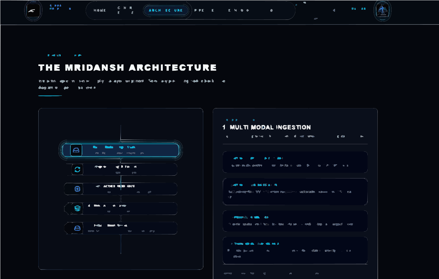
THE MRIDANSH — System Architecture
Architectural Philosophy
THE MRIDANSH is designed as a modular scientific computing architecture in which heterogeneous Earth observation data are transformed into a continuously updated representation of soil state.
The architecture separates:
- Data ingestion
- Preprocessing
- Feature engineering
- State estimation
- Physics-guided evolution
- Unified soil-state generation
- Domain translation
- Downstream intelligence
This separation allows the core scientific engine to evolve independently from application-specific systems.
1. Multi-Modal Ingestion Layer
The ingestion layer collects heterogeneous observations describing the target region.
Environmental Inputs
The system can incorporate:
- Rainfall
- Temperature
- Humidity
- Solar Radiation
Historical Inputs
Historical information provides temporal context. Potential inputs include:
- Multi-year satellite archive
- Optional prior soil maps
2. Preprocessing & Feature Engine
Raw observations cannot be directly passed into the state-estimation engine. The preprocessing layer performs the required transformations.
Major Operations
Cloud Interrogation
Optical observations are evaluated for cloud conditions:
- Cloud < 20%: Sentinel-2 Optical
- Cloud ≥ 20%: Sentinel-1 SAR
Terrain Normalization
Copernicus DEM information is used for terrain-aware normalization and feature generation.
Spatial Alignment
Datasets from different sources are aligned to a common spatial reference.
Temporal Alignment
Observations acquired at different times are organized into a common temporal framework.
Noise Reduction & Radiometric Correction
Observation noise and undesirable artifacts are reduced, and sensor-specific corrections are applied.
Feature Engineering & Dynamic Multi-Modal Fusion
Raw observations are transformed into computationally useful features and combined into a unified spatio-temporal representation.
3. Spatio-Temporal Representation
The processed information is organized into a four-dimensional computational representation:
Time × Channels × Height × Width
This representation allows the system to model spatial relationships, spectral information, temporal evolution, and multi-modal observations while preserving spatial and temporal context before state estimation.
4. Core Engine — AETHER-MRID1607X
The central scientific engine of THE MRIDANSH is AETHER-MRID1607X. The engine is responsible for transforming observations into the current best scientific estimate of soil state.
Its major components include:
- State Estimation
- Data Assimilation
- Physics-Guided State Evolution
- Spatial Modeling
- Temporal Modeling
- Unified Soil State Generation
5. State Estimation & Data Assimilation
The state-estimation layer uses an Ensemble Kalman Filter (EnKF) based approach for sequentially updating an estimated state as new observations become available:
Previous Soil State → Prediction → New Observation → Observation Update → State Correction → Updated Soil State
This allows the system to continuously refine the estimated state rather than generating isolated predictions.
6. Physics-Guided State Evolution
The physics layer constrains the evolution of the estimated soil state through:
- Hydrological dynamics
- Water flow
- Moisture transport
- Environmental forcing
- Soil physical evolution
This prevents the system from relying exclusively on learned statistical relationships and ensures consistency with relevant physical behavior.
7. AI / Deep Learning Backbone
The architecture incorporates multiple specialized learning components:
- Spatial Backbone (Graph Convolution Network - GCN): Represents spatial relationships and interactions between spatially distributed features.
- Temporal Backbone (ConvLSTM): Models temporal evolution while preserving spatial structure.
- Physics Backbone (Physics-Informed Neural Network - PINN): Incorporates physical constraints into learning and state evolution.
- State Estimation (Ensemble Kalman Filter): Provides sequential state estimation and data assimilation.
Spatial Intelligence + Temporal Intelligence + Physics Constraints + Sequential State Estimation
8. Unified Soil State Vector
The core output is the Unified Soil State Vector, representing the current best scientific estimate of the soil system:
- Hydro-Physical State: Root-Zone Moisture, Bulk Density, Hydraulic Conductivity, Soil Temperature
- Biogeochemical State: Organic Carbon, Estimated Nitrogen, Estimated Phosphorus, Estimated Potassium
- Terrain State: Elevation, Slope, Aspect, Soil Layer Stratification
- Reliability State: Confidence Score, Uncertainty Matrix, Observation Freshness
9. Domain Translation Layer
The Unified Soil State is intentionally separated from application-specific outputs.
          UNIFIED SOIL STATE
                   │
         ┌─────────┴─────────┐
         ▼                   ▼
  AGRONOMIC             GEOTECHNICAL
  TRANSLATOR             TRANSLATOR
         │                   │
         ▼                   ▼
   Agriculture              Civil
Agronomic Translator
Transforms soil-state variables into agriculture-oriented information (Root-Zone Moisture, Soil Health, Organic Carbon, Estimated NPK, Precision Management Analytics, Scenario Simulation).
Geotechnical Translator
Transforms the same soil-state representation into civil-engineering-oriented information (Ground Stability, Soil-State Visualization, Scenario Simulation, Subsurface 3D Profile, Basic Drainage Intelligence).
10. Downstream System — MARGAVEDHA
THE MRIDANSH acts as the scientific soil-state provider for future downstream systems like MARGAVEDHA:
THE MRIDANSH → Unified Soil State → MARGAVEDHA → Advanced Civil Intelligence
Potential MARGAVEDHA capabilities include:
- Dynamic CBR Prediction
- Bearing Capacity Estimation
- Effective Stress Analysis
- Settlement Prediction
- Pavement Failure Assessment
- Structural Stability Intelligence
- Engineering Decision Support
- Autonomous Infrastructure Auditing
11. Continuous Assimilation Loop
The architecture is designed around continuous state updating:
New Satellite Image → Observation Processing → Compare With Current State → Prediction Error → Ensemble Kalman Update → State Correction → Updated Unified Soil State → Dashboard Refresh
12. Complete Architecture
+---------------------------------------------+ | MULTI-MODAL DATA INGESTION | | | | Sentinel-1 | Sentinel-2 | DEM | Weather | | Historical Data | Prior Soil Maps | +----------------------+----------------------+ | v +---------------------------------------------+ | PREPROCESSING & FEATURE ENGINE | | | | Cloud Handling | Terrain | Alignment | | Correction | Feature Engineering | Fusion | +----------------------+----------------------+ | v +---------------------------------------------+ | AETHER-MRID1607X | | | | Spatial AI | Temporal AI | Physics AI | | EnKF State Estimation | +----------------------+----------------------+ | v +---------------------------------------------+ | UNIFIED SOIL STATE VECTOR | | | | Hydro-Physical | Biogeochemical | | Terrain | Reliability | +----------------------+----------------------+ | +---------+---------+ | | v v AGRONOMIC GEOTECHNICAL TRANSLATOR TRANSLATOR | | v v Agriculture Civil | | +---------+---------+ | v MARGAVEDHA | v Advanced Civil Intelligence
Architectural Principle
THE MRIDANSH separates scientific state estimation from domain-specific application logic, allowing one unified soil-state representation to power multiple Earth-intelligence systems.
THE MRIDANSH — Technology Stack
Technology Philosophy
THE MRIDANSH combines remote sensing, geospatial computing, artificial intelligence, scientific computation, physics-guided modeling, and sequential data assimilation.
The technology stack is designed to support large-scale multi-modal Earth observation processing and computationally intensive state estimation.
Development Environment
- IDE: Visual Studio Code
- Notebook Environment: Jupyter Notebook
- Execution Platform: Kaggle Notebook
- Operating System: Windows 11
- Version Control: Git + GitHub
Compute Backend
- Platform: Kaggle
- GPU: Dual NVIDIA Tesla T4 (2 × 16 GB VRAM)
- CPU: Multi-Core Xeon
- Mixed Precision: PyTorch AMP (Used to improve computational efficiency)
- Checkpoint Resume: Enabled (Allows workflows to resume from saved states)
Earth Observation Data
- Optical Satellite: Sentinel-2 L2A
- Radar Satellite: Sentinel-1 GRD
- Terrain: Copernicus DEM (30 m terrain data)
- Weather Variables: Temperature, Rainfall, Humidity, Solar Radiation
- Historical Inputs: Multi-year satellite archive, Optional soil prior maps
Data Access
- STAC API: Structured access to Earth-observation datasets.
- ASF Search API: Sentinel-1 data discovery and access.
- Copernicus Data Space: Primary Earth-observation data source.
- Open-Meteo API: Weather and environmental information.
- Data Formats: GeoJSON, Raster GeoTIFF, NumPy arrays, CSV, JSON.
Core AI Framework
- Language: Python 3.11
- Deep Learning Framework: PyTorch
- Geometric Deep Learning: PyTorch Geometric
- Computer Vision: TorchVision
- Model Evaluation: TorchMetrics
Geospatial Stack
- Raster Processing: Rasterio
- Geospatial Data Processing: GDAL
- Vector Processing: GeoPandas
- Geometry Operations: Shapely
- Coordinate Transformation: PyProj
- Geospatial Xarray: rioxarray
- Multi-Dimensional Scientific Data: xarray
- Numerical Computing: NumPy
Machine Learning
- Libraries: Scikit-Learn, SciPy, Pandas
- Purpose: Statistical processing, Data preparation, Feature engineering, Classical ML, Scientific analysis.
Deep Learning Architecture
- Spatial Backbone: Graph Convolution Network (GCN)
- Temporal Backbone: ConvLSTM
- Physics Backbone: Physics-Informed Neural Network (PINN)
- State Estimation: Ensemble Kalman Filter (EnKF)
Scientific Computation
- PyTorch Autograd: Automatic differentiation and gradient-based optimization.
- DeepXDE: Optional framework for PINN development.
- SymPy: Symbolic mathematical computation.
- Numba: Performance optimization of computational operations.
Visualization
- Matplotlib: Scientific plotting and analysis.
- Plotly: Interactive visualization.
- Folium: Interactive geographic visualization.
- Leafmap: Interactive geospatial mapping and Earth-observation visualization.
User Interface
- Framework: Streamlit
- Interactive Modules: Bounding Box Selector, Agriculture Dashboard, Civil Dashboard, Scenario Simulator, 3D Soil Viewer.
Storage & Configuration
- SQLite: Lightweight application data.
- GeoTIFF: Raster geospatial outputs.
- NumPy Arrays (
.npy): Numerical intermediate and model data. - PyTorch Models (
.pt): Checkpoints and trained parameters. - Configuration: YAML
- Tabular Data: CSV
- Structured Data: JSON
Testing & Quality
- Testing: PyTest, Coverage
- Coverage Areas: Data pipelines, Preprocessing, Model components, State-estimation logic, Output generation, Interface behavior.
Dependency Management & Docs
- Package Manager: pip (
requirements.txt,requirements-dev.txt) - Documentation: Markdown, Mermaid, MkDocs
Deployment
- Source Control: GitHub
- Interactive Demo: Streamlit Cloud
- Future Targets: Docker, FastAPI
Technology Architecture
Earth Observation → STAC / ASF Search / Copernicus / Weather APIs → Rasterio / GDAL / GeoPandas / Xarray → NumPy / Pandas / SciPy → PyTorch / PyTorch Geometric → GCN + ConvLSTM + PINN → Ensemble Kalman Filter → Unified Soil State → Streamlit / Visualization → Agriculture / Civil Applications
Core Technology Principle
The technology stack is designed around the scientific pipeline rather than around a single machine-learning model. THE MRIDANSH combines geospatial processing, physical modeling, artificial intelligence, and data assimilation into one integrated engineering architecture.
THE MRIDANSH — Achievements & Engineering Milestones
Project Status
In Progress
THE MRIDANSH represents a major expansion of the project's engineering scope from individual Earth-observation analysis toward a unified scientific state-estimation architecture.
AETHER-MRID1607X
The central engineering milestone is the definition and development of:
AETHER-MRID1607X — Physics-Guided Unified Soil State Estimation Engine
The engine provides the scientific core of THE MRIDANSH. Its architecture integrates:
- Multi-modal data fusion
- State estimation
- Data assimilation
- Physics-guided modeling
- Spatial intelligence
- Temporal intelligence
- Domain translation
Unified Soil State Concept
One of the primary architectural contributions of THE MRIDANSH is the definition of a common:
Unified Soil State Vector
Instead of building separate systems for agriculture and civil engineering, the system first estimates a common physical representation of soil.
          Unified Soil State
                 │
      ┌──────────┴──────────┐
      ↓                     ↓
 Agriculture              Civil
This provides a reusable scientific foundation for downstream applications.
Multi-Modal Earth Observation Integration
The project architecture integrates multiple sources of Earth and environmental information:
- Sentinel-1 SAR
- Sentinel-2 Optical
- Copernicus DEM
- Weather observations
- Historical satellite data
- Optional soil prior maps
This creates a multi-modal Earth-intelligence pipeline rather than a single-sensor model.
Physics-Guided Intelligence
A major engineering direction of THE MRIDANSH is the combination of AI with physical constraints. The architecture incorporates:
- Hydrological dynamics
- Water flow
- Moisture transport
- Environmental constraints
- Physics-guided state evolution
This approach is intended to improve scientific consistency compared with relying exclusively on purely statistical learning.
Sequential Data Assimilation
The integration of the Ensemble Kalman Filter establishes a sequential state-estimation framework:
Prediction → Observation → Comparison → Correction → Updated State
This enables the estimated soil state to evolve as new observations become available.
Spatial + Temporal Intelligence
The architecture combines specialized modeling approaches:
- Spatial: Graph Convolution Network (GCN)
- Temporal: ConvLSTM
- Physics: Physics-Informed Neural Network (PINN)
- State Estimation: Ensemble Kalman Filter (EnKF)
Spatial + Temporal + Physics + Data Assimilation
Cross-Domain Architecture
THE MRIDANSH is intentionally designed to serve multiple domains:
Agriculture
Potential capabilities include Root-zone moisture, Organic carbon, Estimated NPK, Soil health, Precision management, and Scenario simulation.
Civil Engineering
Potential capabilities include Ground stability, Soil-state visualization, Basic drainage intelligence, Subsurface 3D visualization, and Scenario analysis.
MARGAVEDHA Integration
THE MRIDANSH establishes the soil-state foundation for MARGAVEDHA:
THE MRIDANSH → Unified Soil State → MARGAVEDHA → Advanced Civil Intelligence
Potential downstream capabilities include:
- Dynamic CBR
- Bearing capacity
- Effective stress
- Settlement
- Pavement failure
- Structural stability
- Engineering decision support
- Autonomous infrastructure auditing
Engineering Milestone
The project represents the transition:
Satellite Data Analysis → Earth State Estimation
The system is not simply intended to create another remote-sensing dashboard; its core objective is to estimate the evolving physical state of a geographic system.
Scientific Engineering Direction
The project combines several traditionally separated fields:
- Remote Sensing & Geospatial Science
- Artificial Intelligence & Machine Learning
- Physics-Based Modeling & Data Assimilation
- Scientific Computing & Soil Science
- Geotechnical Intelligence
Current Development Milestone
The project has established:
- Core scientific objective
- Unified Soil State concept
- AETHER-MRID1607X engine architecture
- Multi-modal data strategy
- Processing pipeline
- Physics-guided architecture
- EnKF-based state estimation concept
- Domain translation architecture (Agriculture & Civil pathways)
- MARGAVEDHA downstream relationship
- Technology stack
Project Significance
Estimate the physical state once, then allow multiple domain systems to consume that state.
This principle enables future expansion into Environmental monitoring, Disaster resilience, Digital twins, Precision agriculture, Geotechnical intelligence, and Infrastructure monitoring.
THE MRIDANSH — Development Roadmap
Roadmap Objective
THE MRIDANSH is being developed as a long-term Earth Intelligence platform. The roadmap progressively moves the system from a unified soil-state estimation engine toward a broader ecosystem of downstream scientific and engineering applications.
Phase 1 — Scientific Foundation
- Status: Completed / Established
- Major Objectives: Define the soil-state estimation problem, Establish the Unified Soil State concept, Define AETHER-MRID1607X, Establish multi-modal Earth observation strategy, Define physics-guided architecture, and Define data-assimilation framework.
Phase 2 — Data Infrastructure
- Objective: Build reliable ingestion and preprocessing pipelines for heterogeneous Earth observation data.
- Primary Data Sources: Sentinel-1 GRD, Sentinel-2 L2A, Copernicus DEM, Weather data, Historical satellite archive, Optional soil prior maps.
- Key Tasks: AOI processing, STAC & ASF Search integration, Weather-data integration, Raster preprocessing, Spatial & temporal alignment, Cloud interrogation, SAR/optical strategy, Data-quality control.
Phase 3 — Multi-Modal Data Fusion
- Objective: Transform heterogeneous observations into a unified computational representation (
Time × Channels × Height × Width). - Focus: Feature engineering, Dynamic sensor fusion, Spatial normalization, Temporal alignment, Multi-source feature integration.
Phase 4 — AETHER-MRID1607X Core Development
- Objective: Implement the core state-estimation engine.
- Components: Spatial (GCN), Temporal (ConvLSTM), Physics (PINN), State Estimation (EnKF).
Phase 5 — Physics-Guided State Evolution
- Objective: Introduce physically constrained state evolution.
- Focus Areas: Hydrological dynamics, Water flow, Moisture transport, Environmental forcing, Soil physical evolution.
Phase 6 — Unified Soil State Vector
- Objective: Generate a comprehensive and uncertainty-aware soil-state representation (Hydro-Physical, Biogeochemical, Terrain, Reliability).
Phase 7 — Agriculture Intelligence
- Objective: Translate the Unified Soil State into agriculture-oriented information (Soil Health Dashboard, Root-Zone Moisture Analytics, Organic Carbon, NPK, Scenario Simulation, Precision Management).
Phase 8 — Civil Engineering Intelligence
- Objective: Translate the same soil-state representation into civil-engineering-oriented intelligence (Ground Stability Dashboard, Soil-State Visualization, Subsurface 3D Profile, Scenario Simulation, Basic Drainage Intelligence).
Phase 9 — MARGAVEDHA Integration
- Objective: Use THE MRIDANSH as the scientific soil-state layer for MARGAVEDHA.
THE MRIDANSH → Unified Soil State → MARGAVEDHA → Advanced Civil Intelligence
- Downstream Capabilities: Dynamic CBR Prediction, Bearing Capacity Estimation, Effective Stress Analysis, Settlement Prediction, Pavement Failure Assessment, Structural Stability Intelligence, Engineering Decision Support, Autonomous Infrastructure Auditing.
Phase 10 — Continuous Data Assimilation
- Objective: Move from periodic analysis toward continuously updated state estimation:
New Observation → Prediction → Observation Comparison → EnKF Update → State Correction → Updated Soil State → New Observation
Phase 11 — Interactive Earth Intelligence Platform
- Objective: Expose the scientific system through an interactive interface (Streamlit / FastAPI).
- Components: Bounding Box Selector, Agriculture Dashboard, Civil Dashboard, Scenario Simulator, 3D Soil Viewer, Temporal State Analysis.
Phase 12 — Scalable Deployment
- Future Infrastructure: Docker, FastAPI, Cloud compute, Distributed processing, API-based data services.
Phase 13 — Earth Intelligence Expansion
Expand toward environmental monitoring, disaster resilience, land degradation monitoring, digital twin applications, infrastructure intelligence, and multi-domain Earth observation.
Long-Term Architecture
         EARTH OBSERVATION
                │
                ▼
      AETHER-MRID1607X
                │
                ▼
      UNIFIED SOIL STATE
                │
   ┌────────────┼────────────┐
   ▼            ▼            ▼
Agriculture Civil Environment │ │ │ ▼ ▼ ▼ Analytics MARGAVEDHA Future Systems │ ▼ Earth Intelligence
Ultimate Vision
From observing the Earth to continuously estimating its evolving state.